


Digital Twins, Sustainability and the Future of Smart Cities
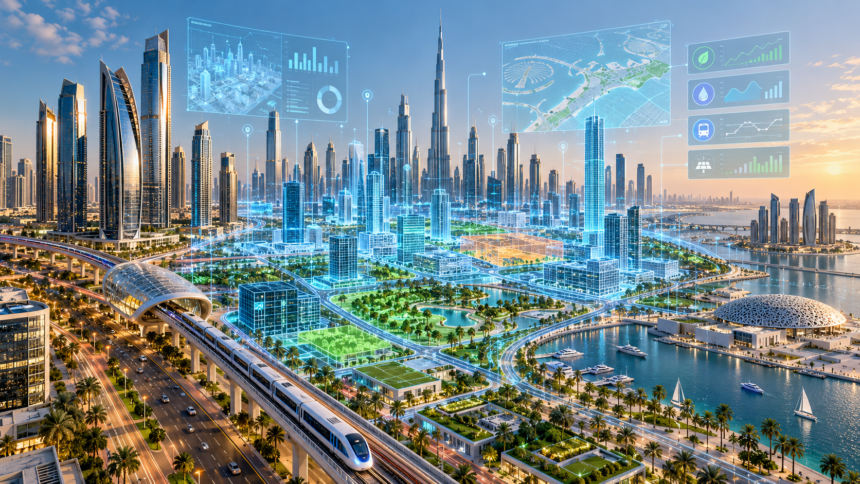
Digital Twins in UAE are changing how governments, urban planners and infrastructure specialists understand and manage rapidly developing cities. By creating detailed virtual representations of buildings, roads, utilities and public spaces, digital twin technology allows decision-makers to examine existing infrastructure and test possible developments before making changes in the real world.
- What Are Digital Twins in UAE and How Does the Technology Work?
- Dubai Digital Twin Platform: How the City Is Building Its Virtual Replica
- Abu Dhabi Digital Twins and the Development of Smarter Communities
- 7 Ways Digital Twins Could Transform Urban Planning in the UAE
- Digital Twins, Sustainability and the Future of Smart Cities
- Challenges, Costs and Data Privacy Risks of Digital Twins
- Future Opportunities, Business Applications and FAQs About Digital Twins in UAE
Imagine being able to explore a digital version of Dubai, identify where traffic congestion may increase, assess the impact of a new residential tower or understand how a neighbourhood might respond to heavy rainfall. Rather than relying exclusively on traditional maps, planners could use connected digital systems to study different scenarios and make more informed decisions.
This is the concept behind digital twins.
Unlike a conventional three-dimensional model, a sophisticated digital twin can connect physical infrastructure with continuously updated information from sensors, geographic databases and operational systems.
The technology is becoming increasingly relevant in the UAE, where rapid urban development, infrastructure expansion and ambitious sustainability goals create complex planning requirements.
Dubai has already introduced a citywide digital twin platform. In July 2026, Dubai Municipality highlighted its progress in converting more than 280,000 infrastructure assets and 330,000 public facilities and assets into three-dimensional models.
The platform also incorporates more than 1,500 geospatial data layers and supports over 100 two-dimensional and three-dimensional applications.
Abu Dhabi is making similar advances. Its Department of Municipalities and Transport announced the Nabd platform in June 2026, designed to connect urban information from more than 70 data sources and over 15 systems. Its first operational phase is expected in early 2027.
These developments indicate that virtual city technology is moving beyond conceptual demonstrations towards practical government applications.
However, digital twins do not automatically solve urban challenges. Their effectiveness depends on accurate data, secure information systems, expert interpretation and coordination between public authorities.
This article explains how digital twins work, why UAE cities are adopting them and seven ways virtual urban environments could influence transportation, construction, sustainability and everyday quality of life.
What Are Digital Twins in UAE and How Does the Technology Work?
A digital twin is a digital representation of a physical object, system or environment that can be connected to information about its real-world counterpart.
At the simplest level, a digital twin might represent a single building or piece of industrial equipment.
At a more advanced level, it can model entire neighbourhoods, transportation networks or cities.
How a Virtual City Is Created
Developing a city digital twin requires information from multiple sources.
Geographic information systems provide maps and spatial information, while building records identify properties and infrastructure.
Three-dimensional models help represent the physical appearance and structure of buildings.
Sensors can supply information about traffic, environmental conditions, equipment performance and other operational activities.
These elements may then be combined into a shared digital environment.
The Main Technologies Behind Digital Twins
| Technology | Purpose |
|---|---|
| Geographic Information Systems | Mapping locations and infrastructure |
| 3D Modelling | Representing buildings and urban spaces |
| Internet of Things | Collecting information from connected devices |
| Artificial Intelligence | Analysing patterns and supporting predictions |
| Cloud Computing | Processing and storing large datasets |
| Building Information Modelling | Providing detailed construction information |
| Simulation Software | Testing potential urban scenarios |
Not every digital twin uses all these technologies. The level of complexity depends on its intended purpose.
Digital Twin vs Traditional 3D Model
A conventional 3D model primarily represents what something looks like.
A digital twin may also include information about how it operates and changes.
For example, a 3D model of a railway station could show platforms, entrances and surrounding roads.
A connected digital twin could additionally incorporate passenger activity, equipment conditions and operational information to help planners evaluate station performance.
Why Continuous Updates Matter
Cities are constantly changing.
New buildings appear, roads are modified and infrastructure is repaired or replaced.
A useful citywide digital twin must therefore be updated regularly.
Without reliable maintenance, the virtual city can become an outdated representation that leads to inaccurate planning decisions.
Dubai Digital Twin Platform: How the City Is Building Its Virtual Replica
Dubai is one of the UAE’s most prominent examples of digital twin adoption.
The city has developed geospatial systems intended to support urban management, infrastructure planning and cooperation between government entities.
Dubai’s Digital Twin Launch in 2026
On July 2, 2026, Dubai announced the launch of its Digital Twin Platform during a workshop involving government entities and strategic partners.
The platform combines spatial and operational information in a digital environment designed to support planning and decision-making.
Dubai Municipality reported substantial progress in converting infrastructure and public assets into detailed digital models.
Dubai’s Digital Twin in Numbers
| Digital Infrastructure Component | Reported Figure |
|---|---|
| Infrastructure Assets Modelled | More than 280,000 |
| Public Facilities and Assets Modelled | More than 330,000 |
| Geospatial Data Layers | More than 1,500 |
| Supported 2D and 3D Applications | More than 100 |
| Platform Launch | July 2026 |
These figures describe reported components of the Dubai project rather than the total number of buildings or facilities in the emirate.
Dubai Here and Geographic Information
Dubai Municipality previously developed the Dubai Here geospatial portal.
The platform provides mapped information that can support planning, analysis and coordination.
Its geographic information systems form part of the broader foundation for digital twin applications.
Dubai Live and Urban Operations
Dubai Municipality launched the Dubai Live platform in October 2025.
It brings together information about municipal operations, construction activity, infrastructure and planning changes.
Digital twins, AI and analytics support its wider objective of helping authorities monitor urban activity.
This type of integration can help planners move from examining individual projects towards understanding how different city systems interact.
Partnership With Dubai Land Department
In October 2025, Dubai Municipality and Dubai Land Department announced cooperation involving digital twins and smart city management.
Their initiatives include the Smart Buildings platform, intended to combine information about buildings, uses and related property characteristics.
Such cooperation can help improve the consistency of information used by planners, real estate authorities and infrastructure teams.
International Technology Collaboration
Dubai Municipality joined the Digital Twin Consortium in October 2026.
The membership creates opportunities to exchange expertise on standards, geospatial technologies and urban applications.
Dubai also highlighted three-dimensional modelling covering more than 195,000 buildings as part of its technical achievements.
Abu Dhabi Digital Twins and the Development of Smarter Communities
Abu Dhabi is also investing in digital planning technologies.
Its approach places particular emphasis on urban liveability, infrastructure information and supporting decisions about future development.
Introducing the Nabd Platform
In June 2026, Abu Dhabi’s Department of Municipalities and Transport announced Nabd, a platform designed to combine information from different government systems.
Nabd is intended to provide a three-dimensional understanding of the emirate’s urban environment.
Its planned capabilities cover buildings, roads, utilities, underground infrastructure and other important assets.
Abu Dhabi’s Announced Digital Planning Capabilities
| Feature | Announced Capability |
|---|---|
| Connected Data Sources | More than 70 |
| Integrated Systems | More than 15 |
| City Representation | Three-dimensional urban model |
| Planning Information | Infrastructure and operational data |
| Community Insights | Liveability indicators |
| Expected First Operational Phase | Early 2027 |
The first operational phase is expected in early 2027, meaning that the complete proposed capabilities should not be described as already available across Abu Dhabi in October 2026.
Understanding Liveability Indicators
Liveability refers to how well an area supports residents’ everyday needs.
Measures may include the accessibility of schools, transport, healthcare, parks and community facilities.
A digital planning platform can bring such information together to help identify areas that may need additional investment.
For example, planners could examine whether a developing neighbourhood has sufficient access to public services.
LivAI and Predictive Planning
Abu Dhabi has also developed LivAI, an enhanced digital twin and AI platform presented at GITEX Global 2025.
It supports visualisation of liveability information and analysis of planning scenarios.
These capabilities may help authorities evaluate possible developments before committing resources.
Visualising Future Neighbourhoods
Abu Dhabi’s Our Holographic Future initiative uses three-dimensional visualisation technology to help planners study proposed developments.
This can make complex planning concepts easier for technical teams and decision-makers to understand.
However, an impressive visual representation should still be supported by reliable engineering, environmental and economic analysis.
7 Ways Digital Twins Could Transform Urban Planning in the UAE
Digital twins have potential applications across transportation, construction, public services and environmental management.
Their greatest value comes from allowing planners to study how different urban systems interact before making expensive or difficult-to-reverse decisions.
1. Improving Traffic and Transportation Planning
Urban traffic is influenced by road capacity, public transport, population growth and daily travel patterns.
A digital twin can combine transport information with geographic models to help planners assess potential changes.
For example, authorities could simulate how a new residential development might affect nearby junctions and public transport demand.
The results could inform proposals for road improvements or additional transport connections.
2. Making Construction Planning More Efficient
Major developments involve architects, engineers, contractors and government authorities.
Digital twins may allow project teams to examine how a proposed building connects with surrounding infrastructure.
This could help identify coordination problems involving roads, utilities and underground services before construction begins.
However, digital modelling does not remove the need for physical inspections and regulatory approval.
3. Managing Electricity and Water Infrastructure
Cities depend on reliable electricity, water and other utility networks.
Digital models connected to infrastructure records can help operators identify assets requiring maintenance.
When appropriate sensor data is available, predictive systems may also detect patterns associated with potential equipment failures.
4. Supporting Flood and Rainwater Planning
Heavy rainfall can create challenges in urban environments.
Digital simulations may help engineers assess drainage capacity, surface runoff and areas where water could accumulate.
Such models are useful for comparing potential infrastructure improvements.
Their accuracy depends on reliable terrain information, rainfall assumptions and drainage data.
5. Reducing Energy Consumption
Buildings account for significant operational energy demand.
Digital twins can help examine how design, cooling systems and occupancy patterns influence consumption.
Planners may compare alternative building layouts or energy-management strategies before implementation.
6. Improving Emergency Response
Emergency planning requires a clear understanding of roads, buildings, access routes and critical infrastructure.
Digital representations can support coordination and help authorities assess different response scenarios.
However, access to sensitive infrastructure information must be carefully controlled.
7. Designing More Liveable Neighbourhoods
A city is not defined only by its buildings.
Residents also need access to schools, healthcare, transport, open spaces and community facilities.
Digital twins can help planners compare how different development scenarios may affect access to these services.
Seven Potential Applications Compared
| Application | Digital Twin Function | Possible Benefit |
|---|---|---|
| Traffic Planning | Simulate road demand | Better-informed transport decisions |
| Construction | Model proposed developments | Earlier identification of conflicts |
| Utilities | Monitor infrastructure assets | Improved maintenance planning |
| Rainwater Management | Model drainage scenarios | More resilient infrastructure |
| Energy Efficiency | Analyse building performance | Potential energy savings |
| Emergency Planning | Visualise critical infrastructure | Better coordination |
| Community Planning | Compare service accessibility | More liveable neighbourhoods |
These benefits are potential outcomes, not guaranteed results. The quality of implementation determines whether a digital twin produces meaningful improvements.
Digital Twins, Sustainability and the Future of Smart Cities
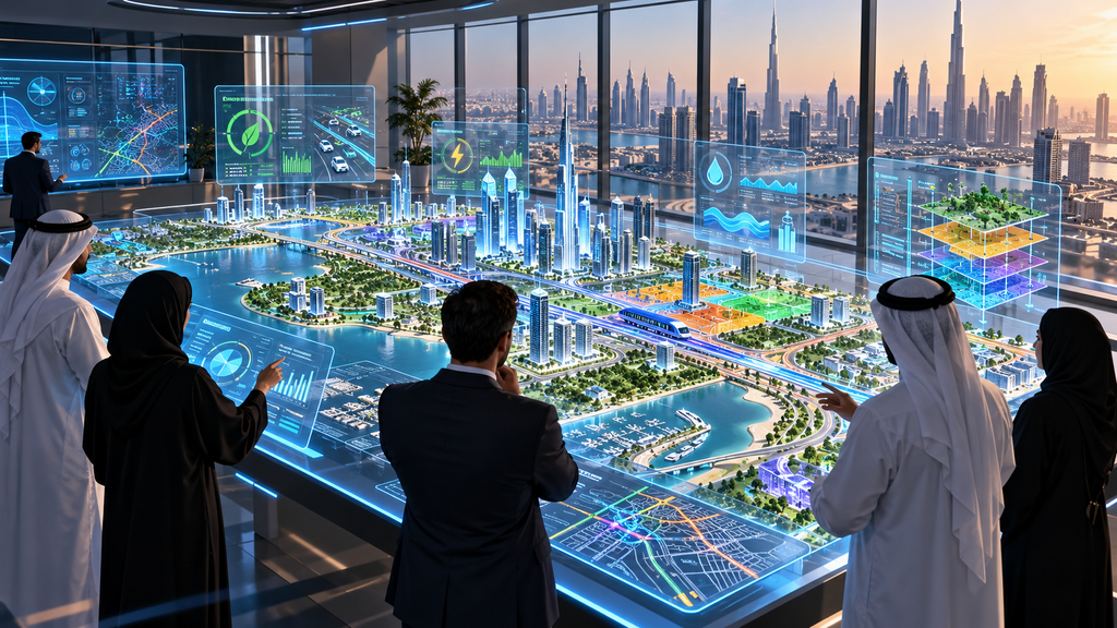
Digital twin technology is closely connected to discussions about sustainable urban development.
As cities grow, planners must manage land, infrastructure, energy and other resources efficiently.
Virtual modelling can support these decisions by allowing different approaches to be evaluated before implementation.
Supporting the Dubai 2040 Urban Master Plan
Dubai’s 2040 Urban Master Plan focuses on long-term development, quality of life and sustainable urban growth.
Digital twins can support such planning objectives by helping authorities understand how infrastructure and communities may change.
For example, planners could examine the accessibility of proposed public spaces or the potential infrastructure requirements of future residential areas.
Digital modelling should complement, rather than replace, broader planning studies and public policy considerations.
Understanding Urban Heat
The UAE’s climate makes temperature management particularly important.
Building density, surface materials and the availability of vegetation can influence local heat conditions.
Digital simulations may help planners compare shading arrangements, building layouts and landscape strategies.
However, reliable conclusions require accurate climate information and validated environmental models.
Supporting Sustainable Buildings
Building performance depends on insulation, cooling systems, design and maintenance.
Digital twins can help identify inefficiencies when appropriate operational data is available.
This could support decisions about maintenance, retrofitting and energy consumption.
Reducing Infrastructure Waste
Construction and infrastructure projects consume substantial materials.
By improving coordination between design and engineering teams, digital modelling may reduce certain avoidable mistakes and rework.
The actual environmental benefit must still be measured against the energy, hardware and infrastructure needed to operate digital systems.
Traditional Planning vs Digital Twin-Assisted Planning
| Planning Activity | Traditional Approach | Digital Twin-Assisted Approach |
|---|---|---|
| Infrastructure Records | Separate documents and databases | Integrated spatial information |
| Project Visualisation | Drawings and static models | Interactive three-dimensional models |
| Scenario Evaluation | Individual studies | Connected simulations |
| Asset Monitoring | Scheduled inspections | Potential sensor-supported monitoring |
| Department Coordination | Separate data exchanges | Shared information environments |
| Environmental Analysis | Independent assessments | Spatially connected modelling |
Digital twins are most effective when they improve the evidence available to qualified professionals.
They should not be treated as automated replacements for engineering judgement.
Challenges, Costs and Data Privacy Risks of Digital Twins
Despite their potential, developing accurate citywide digital twins is technically demanding.
Governments and businesses must consider financial costs, information quality, cybersecurity and the practical value of proposed applications.
High Development and Maintenance Costs
A city-scale system may require specialist software, computing infrastructure, skilled employees and extensive data collection.
Operating costs continue after the initial model is created.
Information must be updated as new developments are completed and existing infrastructure changes.
These expenses should be compared with realistic operational benefits.
Data Accuracy and Integration
Urban information is often held by different organisations.
Records may use different formats, classifications or update schedules.
Combining this information requires common technical standards and clear responsibilities.
Inaccurate or outdated datasets can produce misleading simulations.
Cybersecurity and Privacy
Detailed city models may contain information about sensitive infrastructure.
Connected systems can also process operational or location-related data.
Appropriate cybersecurity controls, access restrictions and data governance are therefore essential.
Personal information must be handled according to applicable privacy requirements.
Avoiding Overconfidence in AI Predictions
Digital twins can produce convincing visualisations and detailed forecasts.
However, their predictions depend on model assumptions and the data used.
An inaccurate assumption about future population growth or travel behaviour could affect the reliability of planning recommendations.
Human review and independent validation remain important.
Major Challenges and Practical Responses
| Challenge | Practical Response |
|---|---|
| High Costs | Prioritise measurable use cases |
| Outdated Data | Establish regular update procedures |
| System Compatibility | Use agreed technical standards |
| Cybersecurity | Apply access controls and monitoring |
| Privacy | Limit unnecessary personal data |
| Prediction Errors | Validate models against observations |
| Skills Shortages | Train technical and planning teams |
What Makes a Digital Twin Successful?
A successful digital twin should solve identifiable problems.
Useful performance measures might include improved asset information, shorter coordination times, more reliable infrastructure planning or reduced avoidable maintenance.
The objective should not simply be to create the most visually impressive virtual city.
Future Opportunities, Business Applications and FAQs About Digital Twins in UAE
The development of digital twins may create opportunities for technology businesses, engineers, construction companies, researchers and infrastructure operators.
However, the size of those opportunities will depend on actual project requirements and commercial adoption.
Opportunities for Technology Companies
Digital twin projects require specialist capabilities in geospatial data, software development, sensors, cybersecurity and simulation.
Companies with expertise in these fields may contribute to public or private projects.
They will still need to meet relevant procurement, technical and regulatory requirements.
Applications in Real Estate
Developers may use digital representations to evaluate building designs and communicate proposed developments.
Connected information can also support facilities management after construction.
However, a visual simulation should not be treated as a guarantee of a property’s future performance, value or investment returns.
Skills for Future Professionals
Students and professionals interested in digital twins may benefit from developing capabilities in:
- Geographic information systems.
- Building Information Modelling.
- Three-dimensional modelling.
- Data analytics and artificial intelligence.
- Civil and infrastructure engineering.
- Urban planning.
- Cybersecurity and data governance.
The field combines technical knowledge with an understanding of how cities operate.
Frequently Asked Questions
What is a digital twin in simple terms?
A digital twin is a virtual representation of a physical object, system or environment that may incorporate data about its real-world condition and performance.
Does Dubai have a digital twin?
Yes. Dubai officially launched its Digital Twin Platform in July 2026, building on earlier geospatial initiatives.
Is Abu Dhabi developing digital twin technology?
Yes. Abu Dhabi announced its Nabd platform in June 2026, with the first operational phase expected in early 2027.
How can digital twins help traffic planning?
They can support simulations involving roads, developments and transport demand, helping planners compare potential improvements.
Do digital twins use artificial intelligence?
Some digital twin systems use AI for pattern recognition, forecasting and analysis. AI is not required for every digital twin.
Can residents access virtual city platforms?
Access depends on the platform. Some geographic information services are publicly accessible, while detailed operational systems may be restricted to authorised users.
Are digital twins completely accurate?
No. Their accuracy depends on the quality, completeness and timeliness of information, as well as the assumptions used in simulations.
Final Thoughts on Digital Twins and UAE Urban Planning
Digital twins represent an important development in how cities can be designed, managed and improved.
By connecting three-dimensional models with geospatial and operational information, the technology allows planners to examine infrastructure more comprehensively and test potential changes before implementing them.
Dubai’s Digital Twin Platform and Abu Dhabi’s emerging Nabd system demonstrate how the UAE is incorporating these technologies into urban planning.
Their applications extend from traffic and construction to environmental management, public services and infrastructure maintenance.
However, the future of virtual cities depends on more than sophisticated software.
Reliable data, strong cybersecurity, skilled professionals and cooperation between government entities are essential.
Ultimately, digital twins in UAE could help create more efficient, resilient and liveable cities by supporting better-informed decisions.
Their greatest potential lies not in replacing the physical city with a digital version, but in using that virtual environment to improve the way real cities function for the people who live in them.
Editorial Note: This article reflects publicly announced initiatives and project information available through October 27, 2026. Future capabilities are presented as planned or potential applications rather than guaranteed outcomes.
Do follow us on Instagram
Read More – Why Home Organisation Services Are Finding a Market in Dubai