

The Stories Behind Old Maps of the Arabian Gulf
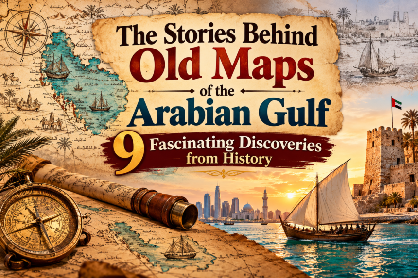
Old maps are more than drawings of coastlines, islands, and cities. They are windows into the past. They show how people understood the world, where merchants travelled, which ports were important, and how explorers described unfamiliar places. When we look at old maps of the Arabian Gulf, we discover stories about trade, pearl diving, navigation, cultural exchange, political influence, and the growth of coastal communities.
- 1. Why Old Maps of the Arabian Gulf Are Historically Important
- 2. Early Maps and the Ancient Understanding of the Gulf
- 3. Portuguese Mapmakers and the First Detailed European Views
- 4. The 18th Century: Maps Become More Detailed
- 5. The Mystery of Qatar’s Disappearance from Some Old Maps
- 6. The British Survey of 1820–1829: A Major Turning Point
- 7. What Old Maps Reveal About Pearl Diving and Trade
- 8. Old Maps Show the Growth of Gulf Ports and Coastal Cities
- 9. How to Read an Old Map of the Arabian Gulf
- 10. The Shift from Traditional Maps to Modern Gulf Mapping
- 11. Where to Explore Historical Maps of the Arabian Gulf Today
- Conclusion: Old Maps Keep the Stories of the Arabian Gulf Alive
- Frequently Asked Questions (FAQs)
Long before modern highways, airports, and satellite navigation, the Gulf was an important meeting point for traders and sailors travelling between Arabia, Persia, India, East Africa, and other parts of the world. Boats carried pearls, dates, spices, textiles, horses, and other valuable goods between busy ports. Sailors depended on local knowledge of winds, currents, islands, shallow waters, and safe anchorages to complete their journeys.
Over time, different mapmakers recorded this changing region. Some used information from ancient geographical writings, while others relied on sailors, merchants, explorers, and official surveys. Their maps did not always show the Gulf accurately. Coastlines could be misplaced, place names could change, and some settlements appeared on certain maps but disappeared from others.
Today, these historical maps are valuable records of the region’s past. Libraries and museums preserve them so that researchers and the public can explore how the Arabian Gulf was understood and represented across different centuries.
In this article, we explore the stories behind old maps of the Arabian Gulf, their connection with trade and maritime life, the people who created them, and what they reveal about the history of Gulf cities.
1. Why Old Maps of the Arabian Gulf Are Historically Important
The Arabian Gulf has connected communities for centuries. Its coastal waters linked trading settlements on both sides of the Gulf and provided routes towards the Indian Ocean.
For sailors, knowing the shape of the coastline was not simply a matter of geography. It could mean the difference between reaching a safe harbour and running into shallow water or dangerous rocks.
Old maps helped people understand:
- The location of ports, islands, and coastal settlements.
- Possible sailing routes between important trading centres.
- Areas with shallow water, reefs, and dangerous rocks.
- Places where ships could anchor or collect supplies.
- The location of pearl-diving grounds and fishing areas.
- Land routes connecting coastal towns with inland settlements.
These maps also reflected the interests of the people who produced them. A merchant might be interested in ports and trade routes, while a naval officer might focus on water depth, coastlines, and safe navigation. A regional ruler might be more interested in settlements, territories, and political relationships.
This is why two maps of the same region can look very different. They may have been created for different purposes and audiences.
The Qatar National Library Heritage Library holds a major collection of historical maps, charts, and atlases covering Arabia and the Gulf. Its collection includes well over 1,200 sheet maps, with examples dating from the late 15th century to the middle of the 20th century. These materials help researchers understand the development of geographical knowledge about the region.
2. Early Maps and the Ancient Understanding of the Gulf
The history of mapping the Arabian Gulf goes back much further than the age of modern European exploration.
Ancient geographers attempted to describe the shape of the known world using written information, mathematical ideas, travel accounts, and reports from merchants and sailors.
One important figure was Claudius Ptolemy, a Greco-Egyptian scholar who lived in Alexandria during the second century CE. His work, Geographia, organised geographical knowledge into a system of locations and coordinates.
Ptolemy’s work became influential in later mapmaking. Although the original maps associated with his writing did not survive in their original form, later copies and printed editions helped spread his geographical ideas across Europe and beyond.
The early appearance of Qatar as Catara
One particularly interesting example concerns Qatar.
The Qatar National Library holds an early printed map based on Ptolemy’s Geographia, titled Tabula Asiae VI or “The Sixth Map of Asia”. It was printed in Rome in 1478 and includes a place name written as Catara, referring to Qatar.
This is significant because it shows that the name associated with Qatar appeared in geographical records long before modern maps and national borders.
It is important to remember that an old map may use a name or location differently from modern maps. Historical spellings were influenced by language, translation, and the information available to the mapmaker.
The map does not necessarily tell us everything about the settlements, population, or political organisation of Qatar at that time. However, it provides valuable evidence of how the region was represented in early European printed geography.
3. Portuguese Mapmakers and the First Detailed European Views
During the 16th century, European maritime powers became increasingly interested in Indian Ocean trade. Portuguese sailors and mapmakers produced charts of coastlines and ports as their ships travelled through the region.
Their maps were influenced by information collected during voyages, along with geographical knowledge obtained from existing trading networks.
One famous example is a Portuguese map made by Lázaro Luís in 1563. It includes the words “Sidade de Catar”, meaning “the city of Qatar”.
The exact settlement represented by the name is not completely certain. Experts have suggested that it may refer to Al-Ruwaidah, a historical settlement in northern Qatar. The map is nevertheless an important example of how Qatar appeared in Portuguese cartography.
The Qatar National Planning Council’s Qatar Atlas history section provides information about this map and other historical representations of the region.
Why were Portuguese maps important?
Portuguese mapmakers helped record coastal features that were useful for maritime travel. Their work reflected the growing importance of sea routes linking Europe, Arabia, India, and other parts of Asia.
Maps from this period could include:
- Coastal outlines and prominent geographical features.
- Names of settlements and ports.
- Islands and points of navigation.
- Important maritime passages.
- Information gathered from earlier journeys.
However, these maps should not be viewed as complete descriptions of Gulf society. Local sailors and traders had their own detailed understanding of the sea, built through generations of experience. European maps represented one part of a much larger history of regional navigation.
4. The 18th Century: Maps Become More Detailed
By the 18th century, European mapmakers were producing increasingly detailed maps of the Arabian Peninsula and the Gulf.
One important example is the work of Carsten Niebuhr, a German mathematician and explorer who travelled to Arabia as part of a Danish expedition. His observations helped improve European geographical knowledge of the region.
His map of the Arabian Gulf, associated with his travels and published in the 1770s, is considered an important geographical record from the period.
The Qatar National Planning Council’s historical map collection identifies Niebuhr’s 1772 map as an important representation of the Gulf before the end of the 18th century. It records several historical Qatari settlements, including Fariha, Al Yusufiyah, and Al Huwaila.
This is valuable because it shows that historical mapmakers sometimes recorded smaller settlements and coastal communities that may not appear in general modern maps.
Jacques-Nicolas Bellin’s 1763 map
Another fascinating example is the 1763 map by French cartographer Jacques-Nicolas Bellin, titled Map of the Persian Gulf.
The map shows Qatar under the name “Catura” and includes locations on both sides of the Gulf. It also identifies Julfar, a historical port associated with present-day Ras Al Khaimah in the UAE.
Interestingly, this map does not include latitude and longitude lines. It reflects an earlier style of maritime cartography, when maps were often designed around practical geographical descriptions and navigational information rather than the precise coordinate systems used today.
The original is preserved in the Qatar National Library collection and can be explored through the Qatar Digital Library.
These maps show how geographical knowledge grew over time, while also reminding us that old maps were not always accurate by modern standards.
5. The Mystery of Qatar’s Disappearance from Some Old Maps
One of the most interesting stories in Arabian Gulf cartography concerns the appearance and disappearance of Qatar on European maps.
The Qatar National Library describes how the peninsula appeared on some maps from the 16th century but was missing from a number of later commercially produced maps.
This can seem surprising. How could a geographical feature that had already been recorded suddenly disappear from maps?
The answer may have something to do with the way later explorers and mapmakers collected information.
Some Portuguese sailors used smaller vessels and could approach shallow coastal waters more closely. Later Dutch and British ships were often larger and may have remained farther offshore.
According to a theory discussed by the Qatar National Library’s historical map specialists, this difference may help explain why some later mapmakers did not show the peninsula clearly.
The return of Qatar on commercial maps
An important chart titled The Gulf of Persia Drawn from the Latest Authorities, produced by British mapmaker J. W. Norie and dated 1823, shows Qatar again.
It includes several place names, such as:
- Zubarah, written as “Zebarra”.
- Khor Hassan, written as “Koor Hufsan”.
- Ras Rakan, written as “Ras Reccan”.
These spellings show how mapmakers adapted local place names into European languages.
The story is a useful reminder that the absence of a location from a particular historical map does not mean that the place did not exist. It may simply reflect limited information, the route taken by the explorer, the scale of the map, or the purpose for which it was made.
You can explore the Norie chart and its history through the Qatar National Library’s article on the 1823 Gulf map.
6. The British Survey of 1820–1829: A Major Turning Point
The early 19th century brought a major change in the mapping of the Arabian Gulf.
In 1820, officers of the Bombay Marine began a systematic survey of the Gulf’s coastal waters. The work continued until 1829 and produced a much more detailed record of coastlines and maritime conditions.
George Barnes Brucks became one of the important figures associated with this effort. He worked alongside other officers who surveyed different parts of the Gulf.
The survey recorded information that was important for safe navigation, including:
- Coastal shapes and geographical features.
- Depth measurements, known as soundings.
- Shoals, rocks, and shallow waters.
- Islands and harbour entrances.
- Prevailing winds and sea conditions.
- The locations of important ports and settlements.
The expedition produced fourteen charts and contributed to written descriptions of the region’s geography, trade, and customs.
The survey was not purely a scientific exercise. It was commissioned by the Bombay Government and was connected to the commercial, security, and political interests of the British East India Company. This is an important part of understanding why certain details were recorded.
The Qatar Digital Library’s account of the 1820 Gulf survey explains why the survey was important and how it improved the geographical information available to European navigators.
Why did this survey matter?
Before the survey, many European charts showed only limited navigation information for particular routes. The new survey provided more extensive details of coastlines, islands, and water depths.
A major chart compiled from these surveys was later published by James Horsburgh and engraved by Richard Bateman. The chart carried the work of George Barnes Brucks and recorded place names in both English and Arabic.
It also reflected the growing use of more systematic measurements in maritime cartography.
The work did have limitations. Differences in measuring longitude and other technical challenges meant that later surveys improved upon some of its details. Nevertheless, the expedition marked a major stage in the development of Gulf mapping.
7. What Old Maps Reveal About Pearl Diving and Trade
The Arabian Gulf was historically famous for its pearl trade. Before the development of the modern oil economy, pearl diving supported many coastal families and communities.
Pearling was not simply an activity carried out at random points in the sea. Divers and sailors relied on knowledge of particular underwater locations, seasonal conditions, and the movement of boats.
Some historical maps and charts recorded pearl banks, shallow areas, and coastal features that were important to maritime activity.
For example, a later British hydrographic chart based on surveys by Constable and Stiffe included an approximate boundary of pearling grounds. The British Library’s archival catalogue describes a 1860 survey map published in 1862 that showed an approximate limit of pearl grounds in the western Gulf.
This kind of detail helps historians study the relationship between geography and the traditional economy.
What can pearl-bank details tell us?
They can help researchers understand:
- The geographical areas associated with pearling.
- The relationship between coastal settlements and offshore resources.
- The importance of shallow waters and islands.
- The way traditional economic activities influenced maritime knowledge.
- How governments and commercial interests recorded valuable natural resources.
Maps are not complete records of the pearl trade. They do not tell us every diver’s story, the daily risks of a pearling journey, or the knowledge passed between generations of sailors.
However, when historical maps are studied alongside photographs, oral histories, trade records, and written accounts, they become valuable sources for understanding the Gulf’s maritime heritage.
8. Old Maps Show the Growth of Gulf Ports and Coastal Cities
Many modern Gulf cities developed around ports, fishing communities, trading settlements, and coastal routes.
Old maps can help historians understand how these places were represented and how their importance changed over time.
Muscat and Oman’s coastal routes
Muscat has long been an important maritime centre because of its position near the Gulf of Oman and the Indian Ocean. Its harbour and surrounding coastline were important for trade and regional travel.
Historical maps often recorded Muscat and nearby coastal features because of their navigational and commercial value.
Bahrain and its island geography
Bahrain’s position in the Gulf made it an important location for maritime activity, trade, and pearling.
The Brucks survey included a chart of Bahrain Island and its harbour, reflecting the importance of accurately documenting the island’s coastal waters.
Kuwait and northern Gulf routes
Kuwait’s coastal position connected it with trading routes across the northern Gulf. Historical maps and charts help researchers understand the development of the coastline and its connection with nearby ports and settlements.
Qatar and historical coastal settlements
The names appearing on older maps, including Zubarah, Al Huwaila, and other historical settlements, provide useful clues about the locations that mattered to sailors and traders.
Dubai, Sharjah, and Ras Al Khaimah
The old settlements of the UAE also formed part of the Gulf’s maritime network. Ports, creeks, coastal trading areas, and nearby islands were important for movement between communities.
The historical importance of a town cannot always be measured by how large it appears on a map. A small settlement might have been important because it offered a safe landing place, access to water, or a connection with an inland trading route.
9. How to Read an Old Map of the Arabian Gulf
Looking at an old map can be exciting, but understanding it requires a little care. Historical maps often use unfamiliar spellings, different scales, decorative illustrations, and geographical information that may not match modern records.
Here are some useful things to look for when studying an old Gulf map.
Check the date and mapmaker
Start by identifying when the map was produced and who created it. A map from the 16th century will have a very different purpose and level of detail from a British hydrographic chart produced in the 19th century.
Look at the title
The title may reveal how the mapmaker described the region. Historical works use names such as “Gulf of Persia” and other period-specific geographical terms. These titles reflect the language and cartographic conventions of their time.
Study the place names
Compare old spellings with modern names. For example, Qatar may appear as Catara or Catura, while Zubarah may be written as Zebarra.
Different spellings do not necessarily indicate different places.
Notice the coastlines
Check whether islands, peninsulas, and harbours are drawn accurately. Early maps may distort shapes or distances because of limited measurements.
Look for soundings and navigation marks
Nautical charts may include numbers showing water depth, as well as symbols for rocks, reefs, shoals, and anchorages.
These details are particularly useful for understanding how ships travelled through the Gulf.
Consider the map’s purpose
Ask why the map was produced. Was it designed for merchants, sailors, military officers, researchers, or general readers?
The intended audience often explains which details were included and which were left out.
10. The Shift from Traditional Maps to Modern Gulf Mapping
During the 20th century, mapping technology changed significantly.
Better surveying equipment, improved navigation instruments, aerial photography, and eventually satellite technology allowed geographers to create more accurate maps.
Maps increasingly included information about:
- International boundaries and administrative areas.
- Roads, ports, airports, and settlements.
- Geological features and natural resources.
- Oil and gas exploration areas.
- Shipping channels and modern maritime infrastructure.
- Urban growth and land use.
The development of oil industries also increased the importance of geographical surveys. Maps were used to record geological features, transport routes, pipelines, exploration areas, and infrastructure.
Modern digital mapping now allows users to explore coastlines, roads, buildings, and other geographical information through computer and mobile applications.
However, old maps have not lost their value. Modern satellite images show what the coastline looks like today, while historical maps help explain how people understood and used that same landscape in the past.
Researchers can compare maps from different periods to study coastal changes, settlement growth, historical routes, and changes in geographical knowledge.
11. Where to Explore Historical Maps of the Arabian Gulf Today
You do not need to be a professional historian to explore old Gulf maps. Several libraries and digital collections make historical materials available to the public.
Qatar National Library Heritage Library: Its collection includes historical maps, atlases, manuscripts, and maritime charts covering Arabia and the wider region. Explore the Heritage Library
Qatar Digital Library: This online collection provides access to historical maps, photographs, documents, and manuscripts related to the Gulf and Middle East. Many records include explanatory notes in English and Arabic. Explore Qatar Digital Library
NYU Abu Dhabi Maps and Mapmaking Collection: The university’s collection traces how maps of Arabia and neighbouring regions changed over five centuries, including early European maps, Ottoman atlases, and modern hydrographic charts. Explore Maps and Mapmaking
Library of Congress: Its digital map collection includes historical maps of Arabia and the Persian Gulf, with information about mapmakers, dates, and geographical features. Explore the Library of Congress map collection
These collections are useful for students, researchers, history enthusiasts, writers, and anyone interested in the development of Gulf cities.
Conclusion: Old Maps Keep the Stories of the Arabian Gulf Alive
Old maps of the Arabian Gulf reveal much more than the shape of coastlines. They preserve evidence of maritime trade, pearl diving, settlement patterns, sailing routes, cultural exchange, and the growth of geographical knowledge.
From the early appearance of Qatar as Catara on a printed map in 1478 to the detailed British surveys of the 1820s, each period introduced new ways of recording the region. Maps by Ptolemaic mapmakers, Portuguese explorers, French cartographers, Ottoman geographers, and British survey officers all contributed to the historical record.
These maps also remind us that geography is connected to everyday life. Ports mattered because people traded there. Islands mattered because sailors used them as landmarks. Pearl banks mattered because families depended on the sea. Coastal settlements mattered because they connected communities across long distances.
Today, libraries and digital archives make these historical records easier to explore. By studying old maps alongside photographs, documents, and local histories, we can gain a deeper understanding of the people and communities that shaped the Arabian Gulf.
Every old map tells a story. Together, they help us understand how the Gulf became the connected and internationally important region we know today.
Frequently Asked Questions (FAQs)
1. Why are old maps of the Arabian Gulf important?
Old maps help researchers understand historical coastlines, ports, settlements, maritime routes, trade activities, and changing geographical knowledge. They are valuable sources for studying the social and economic history of the Gulf.
2. When did Qatar first appear on a printed map?
The Qatar National Library identifies the 1478 printed edition of Ptolemy’s Tabula Asiae VI as the first printed map in its collection to show Qatar, using the name “Catara”.
3. Who created important historical maps of the Arabian Gulf?
Important mapmakers and surveyors include Ptolemy, Lázaro Luís, Carsten Niebuhr, Jacques-Nicolas Bellin, J. W. Norie, and George Barnes Brucks. Their work represents different periods and purposes of mapmaking.
4. What did the British survey of 1820–1829 achieve?
The survey carried out by officers of the Bombay Marine recorded coastal features, water depths, harbours, islands, and navigational hazards. It produced fourteen charts and greatly improved the geographical information available to navigators.
5. What do old Gulf maps reveal about pearl diving?
Some historical charts recorded pearl banks and approximate pearling areas. These details help researchers understand how coastal communities used marine resources and how traditional economic activities influenced maritime knowledge.
6. Why do place names look different on old maps?
Historical mapmakers often translated local names into other languages or used spellings based on pronunciation. Differences in language, handwriting, copying, and printing also changed how place names appeared.
7. Where can I find old maps of the Arabian Gulf online?
You can explore historical maps through Qatar Digital Library, Qatar National Library, NYU Abu Dhabi’s Maps and Mapmaking collection, and the Library of Congress.
8. Are old maps of the Arabian Gulf accurate?
Some are surprisingly detailed, especially later nautical charts, but accuracy varies by date, purpose, technology, and the information available to the mapmaker. Old maps should be compared with other historical and modern sources before drawing conclusions.
Do follow us on Instagram
Read More – Amazing Facts and Major Threats to Gulf Desert Biodiversity